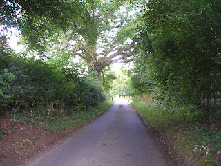
rights of passage - England's Footpath Network
Since the start of writing my Life in the English Cotswolds blog, now over fifteen years ago, overseas readers have repeatedly commented on our network of public footpaths. Mostly it is one of surprise that we can seemingly wander at will over privately owned land and clear any obstruction that may be blocking our way. In this post I hope to clarify what this civil right, now enshrined in law, is all about.

Many of our footpaths are ancient in origin dating back 5000 years or more. Of course, in those days, these paths were the main highways across a wild and untamed land. Even in the relatively recent past much of the road system was a dusty, uncomfortable route to take in summer and not any better later in the year when winter rain turned them into a muddy quagmire. Over many centuries the network of paths was created, usually by local people on foot or horseback taking the most direct and dry route to work or market. This is one of the reasons why paths often pass through farmsteads and gardens.

Today, the public footpaths of England and Wales (Scotland has a different system) are much loved and well-used, mostly for recreational purposes. There are several organisations and charities (see list below) that help to protect the paths and walker’s rights to use them for there are several threats, such as land development for roads and houses, as well as the occasional, unscrupulous landowner. Landowners seem to fall into two categories: those that maintain the paths to allow ease of access and those that allow the paths to fall into disrepair for it is the landowner that is responsible for the path’s maintenance. A well-maintained path is clearly defined across the landscape, its gates and stiles giving ease of access whilst remaining stockproof. By statute, where a path crosses a road, the local council must signpost it.


After many years of campaigning, England created its first long-distance path, the Pennine Way, in 1965. It is 268 miles in length and runs down the spine of northern England passing through spectacular countryside. Today, there are many of these long-distance paths as well as shorter, circular paths. However, with a good Ordnance Survey map (paper or app) it is possible to create your own route whether it be for an hour’s stroll or for much longer. In 2010 the Slow Ways network linking various paths and lanes, villages and towns, across the whole country was created, one of the few benefits to have arisen from the Covid-19 lockdown when walking alone was one of the few permitted activities. The routes listed are all tried and tested by local people who walk them regularly.


In the Ordnance Survey map illustrated above the footpaths are clearly defined using red dashes. The short dashes show footpaths (walkers only) whereas bridlepaths (walkers, horses and bicycles) have long dashes. The broken short-long dashes mark those tracks that can be used by horse-drawn vehicles (“restricted byway”). Some paths have signs along their routes showing not just the route but also the path’s category.

As mentioned, paths frequently cross farmland or other enclosed land. A way through a fenced or walled area must be maintained at all times. Below are illustrations of some of the different types of barriers you may come across although none must prevent you from continuing along your route. If it’s a route for horses the rider must be able to open the gate without dismounting.


Visitors to England often spend far too much time in the major cities or tourist hot-spots (the Cotswolds have lots of those!) returning home not realising that they have missed the opportunity to see parts of the country that never feature in the travel magazines – the homes and villages, the woodlands and old drover’s tracks that can be found all over the country. You may choose to walk alone but when you do meet someone, they are often local and happy to exchange greetings and share a few minutes in dialogue.


Not everyone, of course, feels comfortable walking by themselves, especially in an area unknown to them. Fortunately, there are a lot of local groups or larger organisations such as the Ramblers Association that will welcome you on a regular or one-off basis. Occasionally you may even find an individual who’ll be happy to share with a visitor a favourite walk or place – I’ve done it myself and made some good friends along the way. That is one of the best things about walking, the walks can be short or long, easy or arduous, solitary or in company but it is the interesting conversations you have, the beautiful scenery you pass through, and the wildlife you encounter that make such a memorable experience. Why not give it a try?

Useful Links
click on the organisations below to visit their webpage
Cotswold National Landscape – Guided Walks
National Trust – walks in Gloucestershire and the Cotswolds
Ordnance Survey
Ramblers Association
Slow Ways
The Cotswold Way – a 102 mile trail that takes you through the heart of the Cotswolds to the Roman city of Bath, a UNESCO World Heritage Site.
The Long Distance Walkers Association
Walking in the United Kingdom

Comments
Post a Comment